Building an accurate 3D training dataset is crucial for developing AI models, as 3D data is commonly used across a wide array of industries, including autonomous driving, robotics, and augmented reality. 3D data is considered a critical factor in improving model performance, and one of the most valuable types of 3D data is point cloud data. Today, we are excited to announce that you can now label point cloud data on the Superb Platform!
What Are Point Clouds?
Grouped Data Points that Represent an Object or an Area in a 3D Space
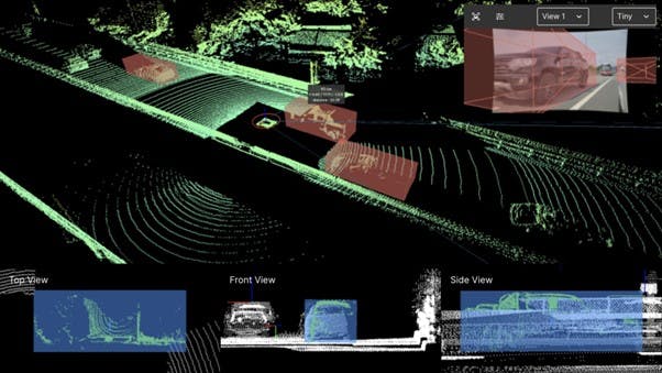
Point clouds are discrete sets of 3-dimensional data primarily captured using LiDAR sensors. These points represent individual data points with x, y, and z coordinates in 3D and are scanned by sensors. Point clouds are employed to describe 3D media and are widely adopted in various industries, including Virtual Reality (VR), Augmented Reality (AR), Mixed Reality (MR), and autonomous driving.
Similar to how videos are filmed, point clouds are usually captured sequentially. Typically, they are filmed at a lower frame speed (5-10 fps) than image data, and each frame is referred to as a Scan. Point cloud data is frequently saved with the *.pcd extension, which includes information about the LiDAR sensors and the numerous points represented by x, y, and z coordinates. In autonomous driving scenarios, a single frame can contain anywhere from tens of thousands of points to even millions. In the case of large-scale point clouds, the number can reach up to billions to describe a large area, like a city. Such point clouds are generated by incorporating multiple scans into one.
What Is LiDAR?
A Sensor Technology that Captures the High-Resolution Information of a Space to Collect Point Cloud Data
LiDAR, short for Light Detection And Ranging, is a sensor technology that is instrumental in acquiring point cloud data. LiDAR employs light in the form of pulsed lasers to measure the distance between a sensor and an object remotely. This technology can be used to generate a dynamic 3D model commonly found in autonomous driving vehicles.
When an area is scanned with LiDAR, a dataset consisting of point clouds is created, each having x, y, and z coordinates, and some might even contain RGB color information.
What’s the Difference Between LiDAR and Point Clouds?
LiDAR is a sensor that can acquire point cloud data. However, not all point clouds are generated using LiDAR. It is also possible to generate point clouds from images obtained from digital cameras (photogrammetry). Each photogrammetry point cloud contains RGB values, thereby forming point clouds that include color information.
Not every data project requires a high level of precision. Therefore, it’s important to consider the time required for data collection and processing, the scale of scanning, the accuracy of the details required, and the intended use of the scanning results to determine which option is the most effective.
Why Point Clouds?
Point cloud modeling uses accurate distance measurement data provided by LiDAR sensors to recognize the location, size, and orientation of objects. This approach accurately represents the geometric structure, shape, and spatial relationships of 3D objects. The better the accuracy of the modeled environment, the more likely autonomous driving will be safe, and users explore and interact with virtual environments as they would with the real world.
For example, it's crucial to match the distance between a user and an object or surface with their real-world counterparts in a virtual world. This capability allows users to fully immerse themselves in the virtual reality, exploring and interacting as they would in the physical world.
In short, 3D modeling with point cloud data helps achieve spatial accuracy, such as precise location and sizing of objects, to create a highly performant model that offers a more realistic virtual reality or autonomous driving environment.
What’s the Benefit of Processing Point Clouds on the Superb Platform?
In the past, the task of classifying point cloud data was manually conducted, requiring a large amount of data to be manually labeled. Naturally, it was time-consuming and often lacked accuracy. As time passed and technology advanced, it became possible to classify the data automatically. Here are some advantages of processing point cloud data through Superb Label:
- Outstanding Granularity of Information
Labeled point cloud data provides a fine granularity of object information. With https://superb-ai.com/product/automate/, the 3D space and object boundaries are further clarified, and objects' locations, boundaries, and orientations are accurately identified.
- Highly-Accurate 3D Training Dataset
Point cloud data possesses detailed spatial information, critical in improving labeling quality. Using this information, annotations that match the real properties of an object, including shape, size, and location, can be created during the labeling process.
- Efficient 3D Model Training and Validation
Models trained with accurately labeled point cloud data in Superb Label understand the characteristics of objects or spaces in great detail, enabling them to contribute significantly to improving model performance.
Kickstart a Point Cloud Data Project With Superb Label Today
- Step 1: Prepare a meta-information file
Point cloud data (PCD) are often used in autonomous driving scenarios in tandem with the information captured through sensors other than LiDAR. Thus, a point cloud sequence might comprise both the point cloud data files taken by LiDAR and the image data collected alongside PCD. It might also include the location of acquisition and other detailed information recorded by IMU (Inertial Measurement Unit) sensors. Here, note that a meta-information file that holds sync and calibration information is needed for PCD to be used for data labeling or AI model training.
>> See the guide on point cloud data structure and file formats
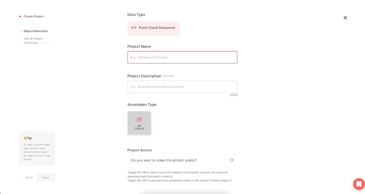
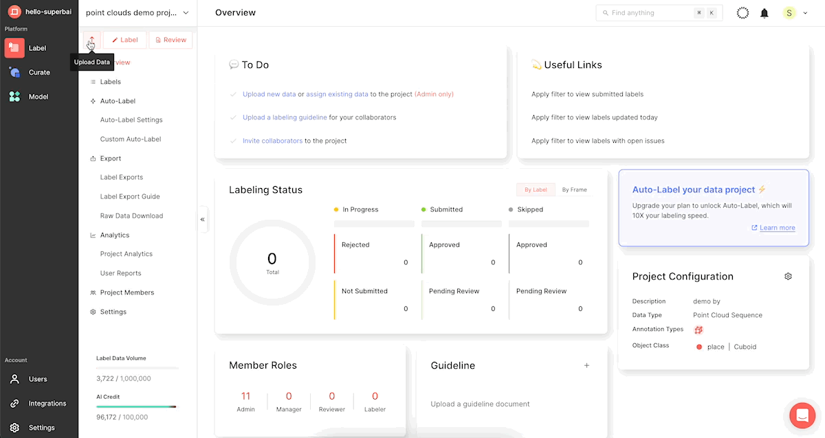
- Step 2: Upload point clouds
SDK Upload
from spb.exceptions import ParameterException, ConflictException pointcloud_sequence_path = './data/pointcloud/50-frames.pcd' dataset='pointcloud-test' pointcloud_data = client.upload_pointcloud_data( manifest_file_path="{manifest file - json}", //local path of the file dataset_name="{dataset_name}",// the name of an existing dataset (Or, you can use a name of a dataset that you are yet to create.) data_key="{data_key}" // You can write and upload a data_key of your choice.)
Point cloud data upload from Superb Label

Unlike image files, opening and inspecting point cloud files for errors before uploading them is challenging. This also holds true when the point cloud files are damaged. After uploading a .pcd file, if you cannot open the file due to errors, please reach out to your customer support manager directly or to support@superb-ai.com so we can assist you.
Data upload after creating a point cloud project in Superb Label
-Step 3: Auto-label point clouds
When dealing with point clouds, a basic (pre-trained) auto-labeling model is unlikely to identify objects accurately. While the hardware (type of camera) doesn't have a significant impact on output for image and video data, this is not the case for LiDAR, as each LiDAR sensor possesses distinct characteristics. For instance, a model trained with data collected using Sensor A (a pre-trained model) will likely underperform with data acquired with Sensor B.
In this context, auto-labeling point clouds with a pre-trained model might not be effective. Instead, training a model with a small volume of labeled data could yield better performance. Therefore, we recommend manually labeling some of your point cloud data and using CAL (Custom Auto-Label) for improved results.
Where Can I Use Point Clouds?
- Autonomous Driving
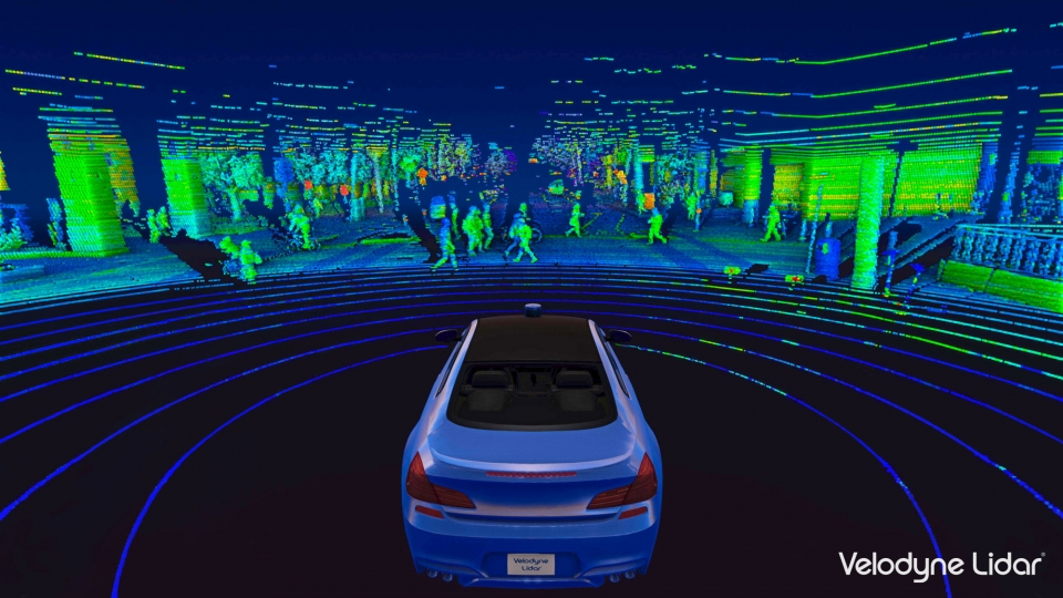
Autonomous vehicles must recognize their surroundings correctly for safe driving. In this context, point cloud data generated by LiDAR sensors attached to the vehicle provides 3-dimensional data about surrounding environments and their distances.
When conducting point cloud modeling with Superb Label, our automated labeling feature helps automatically label various objects, such as cars, pedestrians, bicycle riders, and road infrastructure, to considerably reduce model training time.
- Augmented Reality and Virtual Reality
Point cloud data can be very useful in building immersive AR and VR experiences. Spatial modeling using point clouds helps AR/VR systems add an indiscernible layer to the real world so that users can actively interact with their surroundings and enjoy a more realistic experience.
- Construction and Architecture
Point cloud data can be used for construction sites for site modeling, collision detection, quality management, and so forth. This increases work efficiency, reduces errors, and ultimately elevates the project to perfection.
- Robotics and Drone
In robotics, point cloud data is often used for exploration, obstacle avoidance, and Simultaneous Localization and Mapping (SLAM). Data acquired through LiDAR-mounted drones can be utillized in diverse sectors, such as precision agriculture, wildlife monitoring, and infrastructure maintenance.
Start LiDAR Annotation Now
Point clouds have become a crucial data type for many industries and fields that rely on 3-dimensional data, including architecture, engineering, construction, virtual reality, and autonomous systems. With Superb Label, which offers an auto-labeling feature that automates the resource and labor-intensive task of labeling, teams can process their data more quickly and efficiently. Try Superb Label to build more accurate 3D models and innovate the process of AI model development. Start your free trial now.